The earliest maps of the lower Fraser River area quite rightly focused on the river itself. That was the only transportation route so its bends, narrows, and depths were vital to all transportation.
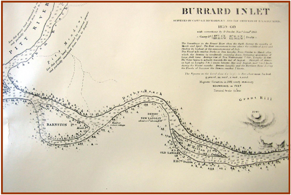
The map shown here is a section of a much larger map drawn in 1859 that shows depth soundings for the whole of the Burrard Inlet region.
Few other features are noted but Grant’s Hill is already labeled as such at this early date. It is interesting to note that it is the first and only official non-native name for this hill that is also called “Thorn’s Hill” or “Thornhill”. The map was made after Fort Langley moved to its second location from the first on Derby Reach.